Summary:
- Ride the route of the original Alaska Highway between Whitehorse and Haines Junction
- 160km total distance, 90 km are off the modern day highway
- Can be a nice one or two-night trip (Friday evening, Saturday & Sunday)
- Mix of highway pavement, backroad pavement, gravel and some interesting abandoned paved sections in the forest.
- Day 2 is particularly nice with last 35 km from Canyon to Haines Junction completely off-road with some really nice gravel riding.
The Idea:
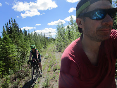
I realized that much of the original route of the Alaska Highway between Whitehorse and Haines Junction still exists. So we found and followed much of it on our bikes and were able to ride about 60%, or about 90 km of the 160 km between the two towns off of the modern day highway. We ended up finding some pretty interest and nice gravel riding, a great way to make the trip. Some of it is well known, such as "Old Alaska Highway" near Whitehorse, or the section through Champaign, but others are either pretty overgrown, or, nice gravel road such as the section of the route that follows the Kluane Wagon Road from Canyon into Haines Junction.
I'm not keen on camping, so I try to find accommodation along the way. We left town Friday after work and stayed at Muktuk Adventures (lots of great accommodation options here, plus great breakfast!). I couldn't find accommodation half way, so ended up leaving our trailer at a friend's place at Mendenhall, but post-pandemic it might be possible to camp/stay at Long Ago People's Place, which would be pretty cool. I haven't talked to them yet, but it would be worth following up next year.
 |
| Here is the 1946 airphoto and you can see how it weaves across to the west where Birch St is now, then back over to Centennial St north. |
Route Overview:
You can do this route as an overnight, riding about 80 km each day. But we did it as a 2 1/2 day trip (two night) leaving town Friday afternoon, then two full-day rides Saturday & Sunday.
Download the route for Ride With GPS: https://ridewithgps.com/routes/36322813
Day 0 - Whitehorse to Old Alaska Highway / Muktuk Adventures - km 1430 to 1442
From downtown, ride about 26 kilometers of the Alaska Highway, then about 4 km off the highway to stay overnight at Muktuk Adventure's cabins.
We started following the old Alaska Highway from Porter Creek where Centennial Road follows the original route of the highway.
Centennial Rd. in Porter Creek is the old Alaska Highway route. - Cross to the west side of Alaska Highway at Super-A where Birch St follows the route of the original highway.
- Cross back to Centennial at Wann Road and follow it to MacDonald Road. We stopped for dinner and a beer at Whiskey Jacks
- A few kilometres on the highway past Crestview and there is a 1 km section of gravel road which is the old highway on the east side before Cousins Airstrip. You can stay off the highway by continuing through the rest stop and follow the ATV trail on the east side to the intersection with the North Klondike Highway.
- Cross the N. Klondike Highway to follow ATV trail on the east side of the highway, climb the hill to access a nice 3 km section of the old Highway, which is now Parent Lane.
- At km 1441 cross to the south side of the highway to find two short loops of the old highway and are now Echo Lake Road and Jackson Road.

Day 1 - Old Alaska Highway to Mendenhall / Champagne - km 1442 to 1496/~1508 +/-
The first full day starts with a nice ride on the paved Old Alaska Highway just outside Whitehorse, a few abandoned sections before Takhini Crossing, and then the longest on-highway stretch - about 28 on highway before you find the next abandoned segment near Stoney Creek. The old section of highway through Champagne is about the half-way point of the trip, so find camping in this area:
- Old Alaska Highway is a 6 km side road which makes for a nice morning ride to start the day. Feels very rural.

- Between here and Woodland Road (km 1453) are three short segments on both sides of the road that are quite overgrown, but ridable on a mountain or gravel bike with hearty tires.

Woodland Rd., last section of old highway for a while. - Woodland Road is the last section of old highway for a while, so it is worth riding. A bit of a scramble back down to the highway at Takhini Crossing.
- After 28 km of mind-numbing road riding (stop to admire the cows and have lunch at the Takhini River to break up the monotony), you again find sections of old highway on the south side - a very short segment at Annie Ned Creek and then a longer section starting at km 1483 just before La Prairie ranch.
- At km 1484 you can follow the old highway on the north side where it crosses Stoney Creek. The bridge is gone, so you'll have to go back to the modern highway to cross the creek, unless you are an obsessive person like me with a partner of infinite patience and insist on wading the creek and bushwacking back up to the old road route.

Crossing Stoney Cr., not remains of bridge on far bank. - At km 1488 you can find an old piece of road on the south side that leads to the Kusawa Lake road. It has been "scarified" so is pretty rough to ride, but you can see a bit of yellow line still on the broken up chip seal.

Remains of yellow centreline along abandoned section of old highway near Kusawa Lake Rd.
You can detour down the Kusawa Rd for a couple of kilometres to reach the Mendenhall River crossing which is a good place to take a swim and cool off. - After crossing the Kusawa Road, cross to the north side of the highway to find another <1km section of old road, better riding this time.

Old asphalt at km ~ 1490, north side of the modern highway. - Now another 5 km on the highway before reaching the Mendenhall Subdivision access road which is another 1.5 km chunk of the old highway you can ride through.


We stayed the night at a friend's property at Mendenhall, so depending on where you camp adjust your day 1->2 break.
Day 2 - Mendenhall / Champagne to Haines Junction - km 1496/~1508 +/- to km 1578
Day 2 is the better day with lots off-highway riding and some interesting discoveries. The longest "on-highway" stretch is about 14 km from the west end of the Champagne road to just before Cracker Creek. From Cracker Creek onward, the route get fabulous with fun abandoned paved sections to the fast gravel ride on the Kluane Wagon Road / Marshall Cr. road for the last 35 km of the route:
- After the Mendenhall section, cross to the south side of the highway at km 1497 to avoid the big hill. This takes you on a gravel trail through a really nice grassland that is worth the detour.

Trail through nice south-facing grasslands allow you to bypass the big hill after Mendenhall - About a kilometer and a half later, you can cross the the north side of the highway for a nice three km gravel section of the old highway (starts at km 1500)
- After crossing the Mendenhall River you get to the old highway Champagne. This is a leisurely 14 km paved road with very little traffic, and of course the highlight is the history-rich village of Champagne.
- 14 km more of dull highway riding - this will make you thankful for what comes next.
- At km 1533 you finally get to leave the highway to access another old section of road on the north side, just before Cracker Cr. It returns to the highway to cross the creek, then again departs on the north side for another kilometer of pleasant gravel and fast-rolling abandoned paved road - very fun!

Abandoned paved road west of Cracker Creek. - At km 1537 starts the really interesting paved but overgrown 8 km segment of road. This is the highlight of the trip. Zipping along fast through the forest and wildflowers on a paved abandoned road. Felt like riding on those abandoned airfields you see, but it is covered in wildflowers! You'll want a gravel bike or mountain bike because it can be a bit rough. But this section between here an Canyon is defiantly a rare and unique find, well worth the ride.

- You can get resupplied with sugary and salty treats at Otter Falls RV park (km 1546), then cross the Aishihik River on the heritage bridge, and from here on, it is off-highway gravel along the Kluane Wagon Road and Marshall Creek road! Cross the old wood bridge, then it is a bit of sandy push up the hill.

A sandy push up the hill after crossing the Aishihik River. - Cross to the south side of the highway at the top of the hill for a really nice, smooth gravel through open forest - about 5 km.

Kluane Wagon Road, west of Canyon - some pretty sweet gravel riding. - At km 1553 you'll cross the highway to continue on the Kluane Wagon Road north of the highway. Again, another 5 km really nice gravel riding, this time through pretty aspen forests.

This mind-numbing road is what you get to bypass by following the old route!
- You'll cross the highway again to the south side at km 1557 to access the Marshall Creek road, which is the last 20 km of the ride, leading you to Haines Junction. Overall this last section is downhill and fast riding gravel road. You do need to ford Marshall Creek, but most of the year it isn't that bad. After that it is nice views of the Dezedeash River, some farms and then you are there, Haines Junction and historical mile 1016.

Fording Marshall Creek. 2021 was a record snowpack year, so the creek was in flood. 
The End.


I have an album of more photos and videos from the trip (for inspiration purposes!) on Facebook at: https://www.facebook.com/media/set/?set=a.10159339060738936&type=3

