I had a copy of the new Toronto cycling map and decided to take a route so I could check out the new "Cycle Track" on Sherbourne Street. I'll describe it a bit later on, but for those not familiar with it, a cycle track is a type of "bike lane" that is somehow physically separated from the roadway. It might be the premier type of bike infrastructure because it is fast and direct like a bike lane, but provides cyclists extra security and comfort by separating the bike lane from the car lane. I noticed that when I was in Sweden this summer that this is the most common type of bike infrastructure there, even in the far north winter cities we visited.
 |
| Raised cycle track on Sherbourne Street, Toronto |
Anyway, back to my route. The first thing the struck me is the random, disconnected nature of the bike infrastructure - take a look at this map, do you see any logical routes or connectivity?
 | |
| Section of Toronto Cycling Map - random bits of bike infrastructure, not connected nor logical routes. Blue lines are simply "recommended" streets to use and don't represent bike lanes or other infra. |
 |
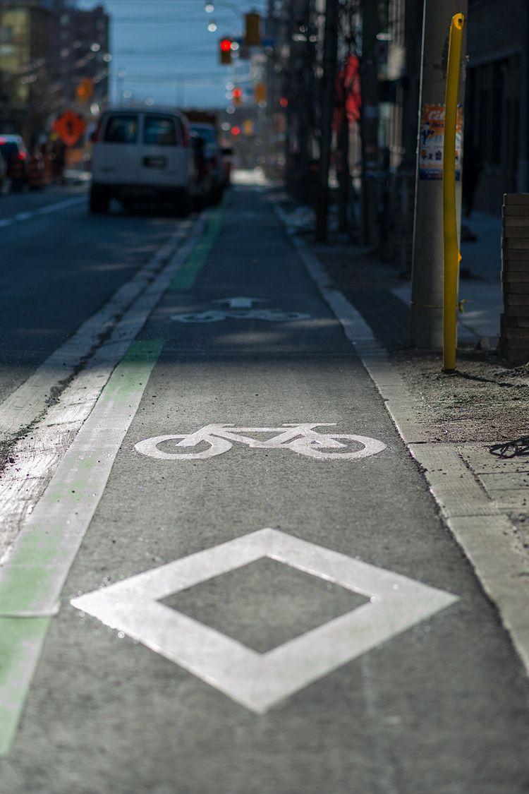
| Diminutive bike route signs |
Now, at this point I was pretty disappointed with how terrible cycling in Toronto is. But then, I thought back to when I lived here in 2001, and back then there was NO bike maps, NO bike infrastructure, so I guess they actually have come a long way. But, definitely the Car rules in Toronto.
Finally I made it to the Sherborne cycle track. It runs north-south pretty much the length of downtown - so you can traverse downtown on separated bike route, which is quite nice (I've circled in in red on the map):
 |
| Sherbourne Street cycle track running the length of downtown north-south. |
It is pretty nice - fast and comfortable. I found a little YouTube video of the track; it is of the upper part of the track which has a divider between the roadway and the cycle lane:
The upper section of the cycle track uses a low barrier to separate the roadway from the bike lane.
 |
| Cycle track with barrier type separation. |
I don't know how well this would work in a winter city from a plowing perspective as it would have to be plowed separately, which is in fact what they do:
 |
| Plowing of Toronto cycle track |
 |
| Raised cycle track with low roll-over curb. |
Another thing I noticed was the abundant use of markings (paint/thermoplastic, etc), which I'm always suspect of because in Whitehorse it always gets worn off in the winter. But, then I remember that in low-traffic streets, the paint on our streets does last a long time. I think we just lose the paint where there is a lot of motor vehicle traffic that tears the paint off when the streets are sanded. So now that I think about it, I think the paint on a cycle track in Whitehorse would last pretty well.

After my fun ride down the cycle track, I then proceeded to get lost in the mayhem of downtown Toronto. I think the car congestion in Toronto is worse than I ever remember it. All the more reason this city needs to spend on getting people out of their cars.
The rest of my ride was back to ratty old bike multi-use bike trails/paths up the Don Valley. The trails are badly neglected, lots of pot holes, twisty and convoluted routes that go through parking lots, use road ways, etc.
I did get to ride along a new cycle path (two way) along Queen Quay which looks like is just getting finished and is obviously incomplete with a few gaps - it is a two-way shared pathway with laneway markings. I didn't find any good pictures, but here is one earlier on in its construction:
 | ||
| http://www.ibiketo.ca/taxonomy/term/21?page=1 |
Anyway, the weather was amazingly nice for first week of October and so it was great to get out for a sunny, warm bike ride.

